Where Does The Manaslu Circuit Trek Start And End?
The Manaslu Circuit Trek is a great trail that is located to the northwest of Kathmandu and is close to the Tibetan border. The drive to the trailhead is also worth noting since it involves a long and winding road from Kathmanduto Dhading Besi, Arughat, Arkhet, and Soti Khola to Machha Khola or Jagat, depending on which trail you choose.
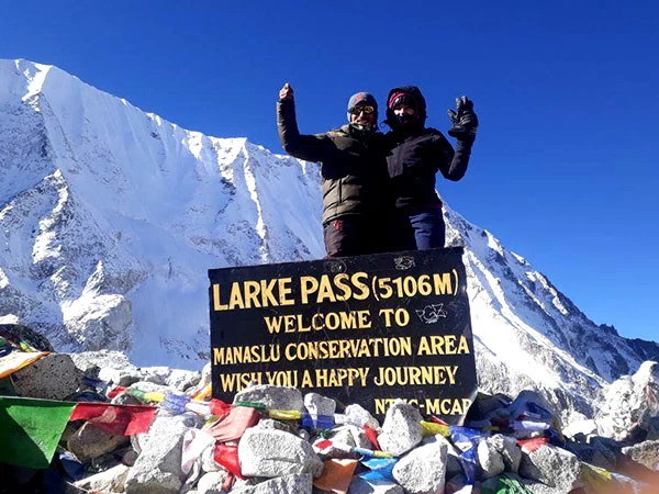
From here, you hike along the Budhi Gandaki valley to the north through various places, including Deng, Namrung, Lho, and Samagaon, from where you can witness the transition from verdant lowland hills to the Himalayan heights. From Samdo and Dharmasala, the Larkya La pass (5,106 meters) is climbed. After the pass, the trail descends through Bhimthang, Gowa, and Tilije toward Dharapani, where the Manaslu route connects with the Annapurna trekking routes. From there, a road journey takes you to Besisahar and eventually back toward Kathmandu.
Because the Manaslu region is close to the Tibetan border and has a sensitive cultural and environmental setting, it is a restricted trekking area. You need the appropriate restricted-area permits and must trek with a licensed guide; independent trekking is not permitted.
This is where having someone who actually knows the place comes in handy. Our guides come from mountain and remote village communities in the Manaslu region, including Gurung and Buddhist Lama communities, so the villages and culture along the trail are not exactly unfamiliar territory. The guides are government-certified, English-speaking guides trained in trekking, first aid, and mountain rescues.
In addition, they can also assist you with any practical questions along the trail, such as photography and videography spots, accommodations, day excursions, trail conditions, and other titbits of information that you may not find on a map.
Main Villages You Pass On The Manaslu Circuit Trek Route
Starting Point: Machha Khola / Soti Khola
The Manaslu Trek starts in the lower Himalayan foothills, where it is still warm, the river valleys are lush, verdant places, and the mountains still retain an air of modesty as they rise higher above the valley. Depending on which trail you take and your road conditions, you could start your trek at either Machha Khola or Jagat and follow the huge Budhi Gandaki River as it snakes deeper into the valley.
This early stretch gives you a pretty good preview of what is coming. The trail winds up and down steep hillsides, crosses suspension bridges over deep gorges, and passes waterfalls, terraced fields, small villages, and a few landslide sites.
It’s a good warm-up for the legs for the hikes to come. The trail is pretty much green and white, with rivers and waterfalls cascading down the rocky mountainsides and large valley walls. Machha Khola usually serves as one of the first major overnight stops.
Lower Manaslu Villages: Jagat And Deng
Jagat is the point at which the Manaslu Circuit trek really loses its accessibility and begins to experience complete remoteness. In addition, it serves as a controlling point for your trek permits.
The trail follows the Budhi Gandaki River for the majority of the journey. It passes through smaller hamlets, forests, and rocky mountainous sides.
The trail passes through the villages of Philim and Sirdibas, where you see traditional houses, local terraces, and an insight into a way of life in Nepal. The trail leads to Nyak Phedi, a small village set around 1,500 meters consisting of stone houses and farmhouses. This village used to be a resting point for merchants and herdsmen passing through the Budhi Gandaki Valley.
The trail continues into forests of bamboo and pine, where you may encounter birds, langurs, and smaller wildlife. The trail then opens up to the village of Deng. It gives the impression of a Gurung and Tibetan-influenced culture, in addition to beautiful valley views and glimpses of mountain ranges such as the Annapurna II and Ganesh Himal on clear days.
The High Himalayas: Namrung, Lho, And Samagaon
The stretch from Namrung to Lho is full of the old suspension bridges that carry you across the Budhi Gandaki River, with steep gorges below and forests all around. Once you reach Lho, though, the scenery starts changing gears. The trail leaves most of the bridge-hopping behind and enters the upper Nubri Valley, where huge mountain views begin stealing the show.
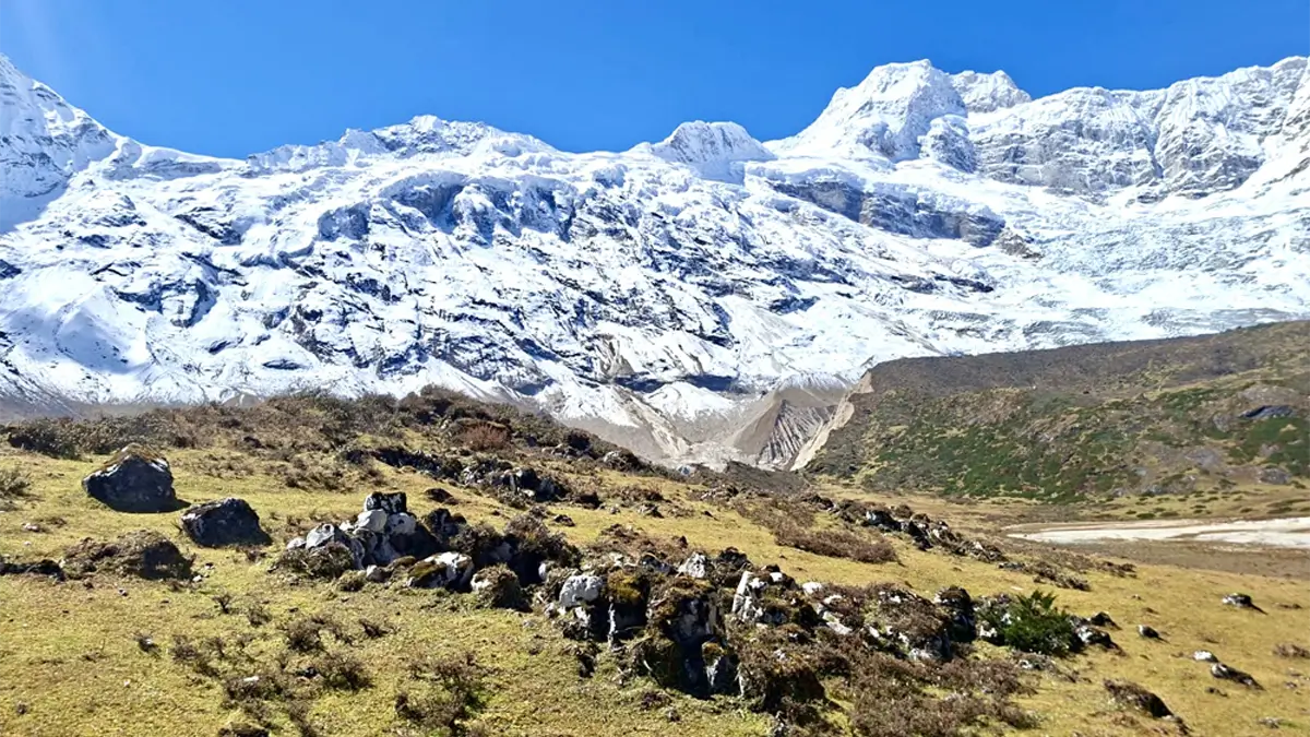
As the forest opens up, Manaslu, Himalchuli, Ngadi Chuli, and Siringi Himal peaks appear on the horizon. The trail winds through long mani walls, stone chortens, prayer flags, and seasonal alpine meadows on the way to these Himalayan giants, providing a unique Tibetan Buddhist feel to the landscape. Perched on a hillside above Lho, the Ribung Gompa (Lho Monastery) is an unforgettable sight in itself and well worth a detour if time permits on the way up.
The trail then passes through Shyala, where small tea shops offer a convenient excuse to stop for a cup of tea, and, obviously, to admire the mountains. From here, the trail drops slightly and once again follows the Budhi Gandaki River toward Samagaon, with the landscape becoming wider, colder, and unmistakably high Himalayan.
The High-Altitude Approach: Samdo And Dharmasala
From Samagaon to Samdo, the trail climbs steadily through rocky ridges, old moraines, and increasingly barren high-altitude terrain before opening into the broad basin where Samdo village sits. The greenery is mostly gone by now, replaced by yak pastures, stones, and a whole lot of mountains. Welcome to the high Himalayas.
Samdo is also a good place to slow down and acclimatize. You can hike up Samdo Ri for wide views of the upper Budhi Gandaki Valley, or take the longer Rui La hike along part of the historic Tibetan trade route. The trail winds up gradually through pastures where yaks graze and stretches of rocky moraine offering distant views of Samagaon, the Larkya La, and surrounding peaks. Perched on a rocky outcrop, Samdo has a small Buddhist monastery, while mani walls, chortens, and prayer wheels punctuate the village as you wander through this Tibetan Buddhist region. Feel free to spin the wheels and walk clockwise around sacred structures.
Leaving Samdo, the trail passes through a small pine forest and the Larke Bazaar, a seasonal Tibetan trading spot. It then drops toward the Budhi Gandaki River, crosses a wooden bridge, and climbs again beside rocky slopes and two small streams, with views toward the Larkya Glacier. The route eventually circles the Salka Khola Valley before climbing once more to Dharmasala, also known as Larke Phedi, the final overnight stop before the big Larkya La crossing.
Crossing Larkya La Pass And Descending To Bhimthang
From Dharmasala, the big day begins early. Really early. You set off with a packed lunch, plenty of drinking water, and a healthy skepticism about life in general, which should get you to question every choice you make halfway up the trail. It is freezing this early in the morning, and reaching Larkya La pass before the weather clears, giving you more time to cross the pass.
The trail winds up the rock-strewn high altitude landscape to the Larke glacier and becomes even steeper as it nears the pass. There are a couple of tea shops on the way, so you can take a break to warm up, but the last stretch requires a steady effort to get to the top. When you reach the summit of the Larkya La pass, it is all worthwhile to see the panorama that opens up in front of you. The pass offers a magnificent view of Manaslu, Himlung, Annapurna II, Kang Guru, Ganesh Himal, Cheo Himal, and Gyaji Kung peaks.
After capturing memorable photographs, the trail takes a steep descent on a grassy moraine towards Bhimthang. Nestled within a valley bound by mountains and glaciers is a lovely meadow called Bhimthang. The village of Gurung is situated adjacent to the meadow in the lower valley.
Descent To The Lower Valleys: Gowa, Tilije, And Dharapani
After the big Larkya La crossing, the trail finally starts giving your legs a break. Gowa (Goa) comes first, offering a quieter stop with small lodges, green forests, open pastures, and mountain views. It feels more relaxed than the busier checkpoints, and it is also the last village reached by road for the Ponker Lake Trek.
From Gowa, the trail continues toward Tilije (Tilche), a lush mountain village dotted with wildflowers and traditional homes. Sitting above the Marshyangdi Valley, Tilije also marks an important transition toward the Annapurna Conservation Area. After days of rocky high-altitude terrain, seeing all that green again feels pretty nice.
Note: Nowadays most trekkers end their Manaslu circuit trek in Tilje, after trekking from Bhimthang to Tilje and spent a night in Tilje and following morning after breakfast drive a shared jeep from Tilje to Besisahar. From Besisahar take another local transport to Kathmandu or Pokhara.
Tilje to Besisahar around 3-4 hrs drive.
Besisahar to Pokhara around 3:30 hrs drive.
Besisahar to Kathmandu around 5-6 hrs drive.
The route from Dharapani winds through this riverside settlement surrounded by forests, terraced fields, and dramatic ranges of the Himalayas. Warm, gentle slopes, and plenty of teahouses offering hot meals and a proper bed add to the appeal. This is the place to sample the comforts of a 'luxury' trek. It's also the point where the Manaslu circuit joins the Annapurna circuit trail.
You can either return to Besisahar by jeep from Dharapani, or spend the night around Tilije and set off for your drive back. At Besisahar, you change transport again for the drive back to Kathmandu.
Which Parts Of The Manaslu Circuit Have Roads?
The Manaslu Circuit has roads in its lower and finishing sections, but don’t expect the entire trek to turn into a jeep tour. From Kathmandu, vehicles now reach Machha Khola, while rough road sections also extend farther into the lower Budhi Gandaki Valley. Some stretches around Jagat and Philim can involve road walking or jeep traffic, depending on current conditions.
Once you move beyond the lower valley, the road disappears, and the real trekking begins. The section from around Namrung through Lho, Shyala, Samagaon, Samdo, Dharmasala, and Larkya La remains a walking route, with trails, suspension bridges, rocky terrain, and plenty of climbing doing the heavy lifting. After crossing the pass and descending toward Bhimthang, Goa, Tilije, and Dharapani, road access returns, and you can continue by jeep toward Besisahar.
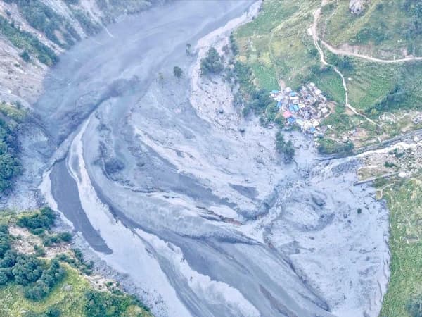
There is also a fresh reminder that mountain roads and trails are never entirely predictable. On September 6, 2026, flash floods around Namrung swept away two bridges and damaged local infrastructure, temporarily interrupting movement toward Samagaonand Larkya La. Local residents, together with the Manaslu Conservation Area Project (MCAP) and local authorities, cleared an alternative trail and built a temporary wooden bridge. The route reopened for trekkers on September 9, although the temporary crossing requires extra care.
Can You Shorten The Manaslu Circuit Trek?
Yes, you can shorten the Manaslu Circuit Trek to around 8 to 10 days by taking a 4WD jeep farther along the road and combining some walking stages. It is a handy option when your holiday clock is ticking, but you still want the big Manaslu experience. Less walking, same mountains.
You can also extend the journey in the other direction and add the Tsum Valley Trek to the circuit that provides you with extra days of experiencing remote villages, monasteries, and Himalayan landscapes before returning to Dharapani, and then continuing onto the Annapurna Circuit to create a far longer route.
The trip can be tailored to suit the time, budget, and style of trekking you want. You can decide whether you want a private trek, a guidedtour, or a group tourin Nepal. You should also know that Manaslu does not necessarily have to be the end of your Himalayanadventure, as it can easily be combined with trips to Everest Base Camp, Annapurna, or shorter treks around the Kathmandu Valley.
FAQs
Where does the Manaslu Trek start and end?
Manaslu circuit trek starts to walk from Machhakhola and is going to end in Tilje or Dharapani. After crossing Larkya La Pass and walking descends to Tilje or Dharapani overnight, and following morning drive to Besisahar and same day to Kathmandu.
How high is the Manaslu Circuit route?
The highest elevation-altitude of the Manaslu Circuit trek is 5,106 meters / 16,752 feet, situated on the top of the Larkya La Pass.
What are the villages passed through on the Manaslu Circuit trail?
On the Manaslu Circuit trail, you will pass through several places, including Machha Khola, Jagat, Deng, Namrung, Lho, Shyala, Samagaon, Samdo, Dharamsala, Bhimthang, Gowa, Tilje, and Dharapani.
How challenging is the Manaslu Circuit trek?
The Manaslu Circuit is a moderate to difficult level trek mainly because of the huge altitude gained and the long hours of walking every day.
Is Manaslu Circuit suitable for a beginner trekker?
A trekker with basic fitness and well-prepared could manage the Manaslu Circuit, although it is not recommended for an inexperienced trekker due to its high altitude and long days of walking.
Is it possible to trek the Manaslu Circuit without a guide?
No, trekking through Manaslu Circuit is not allowed without an experienced and licensed guide. It is mandatory to hire a certified guide who understands the local area and knows the safest and most reliable routes through the region.
How long does the Manaslu Circuit Trek take?
Manaslu circuit trek minimum takes about 12 days from Kathmandu to Kathmandu which is 14 days include your Nepal arrival and departure date, but there are some trekkers doing 12 to 14 days in the mountain and another 2 days arrival and departure from Nepal. and we recommend extra days in case emergency, like bad weather, altitude sickness etc.